Image Credit: On Braillera Plus Tard
Some people are scared to get lost while on a road trip.
While I personally think half the fun of a road trip is taking a wrong turn and getting lost, then having to find your way back, I can see how not everyone would agree with me.
You can go out and purchase an expensive device like a GPS to get the job done, but I’m going to show you how the US interstate system is actually numbered in a way that makes it pretty easy for you to find your way around, even if you don’t know which way’s north.
And if you’re lost just trying to PLAN your road trip, don’t forget to check out our ULTIMATE guide to planning a road trip in the US
Interstate Numbering System Life Hack
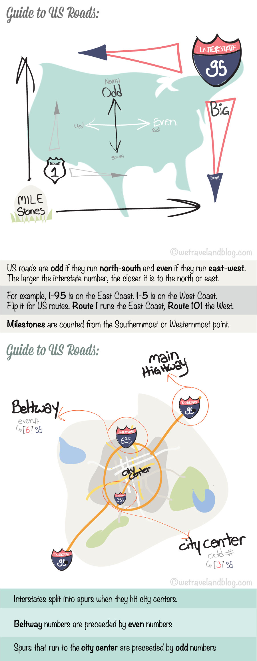
Let me start with a graphic I drew up.
It probably won’t make much sense to you when you first look at it, but read the rest of the post and it will.
It’s a cheat sheet, formatted specially for you to print out and keep as a cheat-sheet with you. Use it as a bookmark for your road atlas and look at it for reference when you forget which is what.
How do I use this information?
Scenario 1-
Ok, bear with me here, but, say you’ve been abducted by aliens and they spit you back out on an interstate somewhere in the US in the dark.
They were nice enough to leave you a car…phwew.. and a US Atlas, which could help, if only you knew where you were on it. You don’t even know which way’s north.
Don’t despair.
First of all, don’t freak out, they’re just aliens. You’ll be fine. Start driving, any direction.
Eventually you will pass a sign on the side of the highway reminding you which road you are on.
Whether you’re on an interstate or state route, check if the number is odd or even.
Let’s say it tells you I-94.
Ok, you know already you’re on a major highway that spans states, it’s an INTERstate. Good, it’ll be easy for you to get home.
Now it’s even. That means it runs East-West. Plus it’s a pretty high number. What does that mean? Look at the graphic.
Interstate numbers get bigger as you go toward the atlantic, or towards canada, so if this is a horizontal (or east-west, or latitude) highway, you’re probably pretty far north, close to canada.
Already without even looking at a map, you know you’re either headed east or west somewhere in the northern states.
Now keep driving you will most likely see little white markers on the side of the road at even intervals, these are milestones, they show up every mile.
Eventually, you’ll see one with numbers on it. Let’s say you pull up to number “110” you now know you’re exactly 110 miles from the sate border. But what state?!?
Keep driving a little longer and you’ll see another one. Let’s say you pass mile marker 100, you know then that you must be headed west on I-94, since the milestones are getting smaller and they start at the western or southern state border.
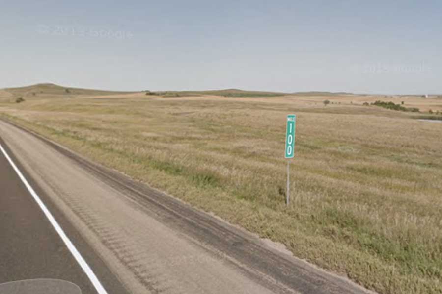
So you’re somewhere close to Canada, headed west on an interstate, about 100 miles from that state’s border. If you crossed another interstate, you’d be able to tell exactly where you are. But there is none in sight, which technically is also an indication.
Wait, that IS an indication. Pull out your Atlas, where does the I-94 run? It runs from Billings to Detroit, through Chicago.
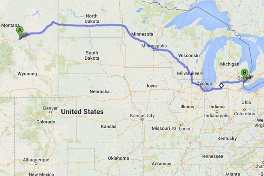
Use the exit numbers on the Atlas. Exit numbers are derived from their closest milestone.
I-94 goes through North Dakota, Minnesota, Wisconsin, Illinois, Indiana, and Michigan
Where are the exits around mile 100 in each state?
If you were in Michigan you’d be seeing signs for Battle Creek, and passing a lot of roads. Not the case.
The I-94 doesn’t span 100 miles in either Indiana or Illinois. So that’s not it.
Minnesota has an exit 100, and you’re not at an exit. So….
Looks like you’re in North Dakota.
The aliens dropped you off on I-94 and you’re now headed west 100 miles from Montana.
No GPS, no compass, complete darkness, you found your exact location on a map. Congrats!
Now here’s another scenario, one that you might use a bit more often.
Scenario 2-
You’re on I-95 headed North from Virgina toward Washington. It’s 4:30 pm and you’re cutting it close with traffic, you really don’t want to get stuck in the city center in rush hour.
Your GPS just ran out of battery and traffic is already picking up and moving at a pretty rapid rate.
You’re not sure how far you are from the city, but you start to see exit signs for 395 or 495. You’re going to have to make many lane changes so you don’t have time to look at your road map.
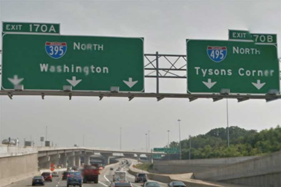
You don’t need to! You know 395 goes straight into town center because the 3 in front of the 95 is odd, and 495 is the beltway because the 4 in front of 95 is even.
Get into your right lane!
That’s it. It’s that easy. You’ll never need a GPS again ;)
How about yourself?
Do you consider yourself geographically challenged?
Do you usually travel with or without a GPS?
Do you absolutely love road maps or loathe them?
Do you think this will help you?


This post cracks me up and I love your graphics, but yeah it all makes sense. Good info!
thanks Corinne! Glad to know we’re making someone laugh :)
aw shucks Reynely, you’re making us blush! We’re really glad, keep on keepin’ on!
I had some serious laughs while reading your article, thank you
for letting me smile like a monkey the last 20 minutes :D
regards from germany sends you
artur aka the life hack dude
Thanks Artur, glad to brighten up your day! You’ve got some good hacks in there! Thanks for stopping by, Cheers,
I love road trips and I also believe that the most fun is not knowing what is ahead of you… even if I get lost I feel great and happily motivated to find my way back or ahead! Lovely blog and lovely post! Thank you for sharing! I had a great time reading the scenarios! :)
Glad to make you laugh Harriet. Thanks for stopping by and leaving such kind words. :) I love getting lost too, but some people are scared of it and it keeps them from exploring.
Come back soon!